GloNews10

In the sweltering heat of the Western Pacific, a monster was born. Super Typhoon Ragasa, the most powerful storm on Earth this year, has carved a path of destruction across the Philippines, Taiwan, Hong Kong, and southern China. With winds peaking at 270 km/h (168 mph)—equivalent to a Category 5 hurricane—Ragasa has claimed at least 17 lives, displaced millions, and caused billions in damages.
As rescue teams scour flooded towns and governments tally the economic toll, experts warn that climate change is fueling these “supercharged” typhoons, making them more frequent and ferocious. This comprehensive report unpacks the storm’s origins, wrath, and aftermath, drawing on satellite data, eyewitness accounts, and official updates.
Ragasa didn’t creep up quietly. Originating from a cluster of thunderstorms north of Yap Island in the Federated States of Micronesia, the storm was first identified as a tropical depression on September 17, 2025. Favorable conditions—warm sea surface temperatures exceeding 30°C (86°F) and minimal wind shear—propelled its explosive growth. By September 18, the Japan Meteorological Agency (JMA) christened it Tropical Storm Ragasa, the 18th named storm of the Pacific typhoon season.
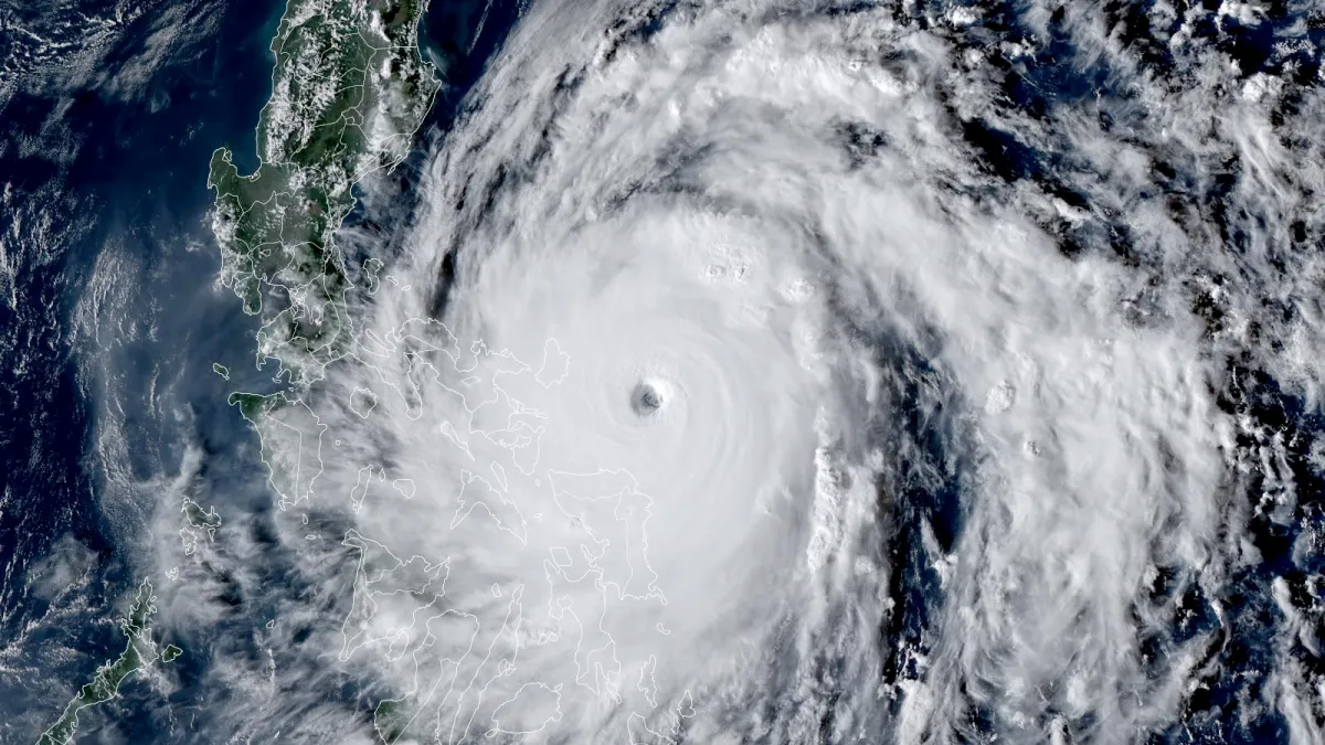
The real terror began on September 20. Upgraded to a typhoon, Ragasa underwent rapid intensification, developing a sharp eye surrounded by a central dense overcast (CDO) of towering clouds. By early September 22, the Philippine Atmospheric, Geophysical and Astronomical Services Administration (PAGASA)—which named it Super Typhoon Nando locally—declared it a super typhoon with sustained winds of 205 km/h (127 mph) and a minimum central pressure of 905 hPa.
The U.S. Joint Typhoon Warning Center (JTWC) pegged one-minute sustained winds at 270 km/h, marking it as the season’s first Category 5-equivalent storm.
An eyewall replacement cycle—a process where a new ring of thunderstorms encircles and strangles the inner core—briefly stabilized its fury, but Ragasa retained super typhoon status as it barreled west-northwest at 15-20 km/h (9-12 mph).
Satellite imagery revealed a compact, symmetrical beast with waves surging 11-12 meters (36-39 feet) high. “This is the strongest tropical cyclone worldwide in 2025,” confirmed the JTWC, outpacing even Super Typhoon Neoguri earlier in the season.
| Key Intensity Milestones | Date (2025) | Sustained Winds (km/h) | Pressure (hPa) | Category Equivalent |
|---|---|---|---|---|
| Tropical Depression | Sept 17 | 55 | 1,000 | N/A |
| Tropical Storm | Sept 18 | 75 | 990 | N/A |
| Typhoon | Sept 20 | 130 | 960 | Category 3 |
| Super Typhoon (Peak) | Sept 22 | 270 | 905 | Category 5 |
| Landfall in China (Weakened) | Sept 24 | 144 | 950 | Category 1 |
Data sourced from JMA, JTWC, and PAGASA reports.

Ragasa’s trajectory was a nightmare for emergency planners. Starting in the open Pacific, it brushed Yap before hooking toward the Philippines’ northern Luzon region. Here’s a breakdown of its rampage:
The archipelago, still reeling from monsoon floods, faced “unprecedented” vulnerability, with PAGASA issuing red alerts for Luzon.
| Region | Casualties | Evacuations | Key Damages |
|---|---|---|---|
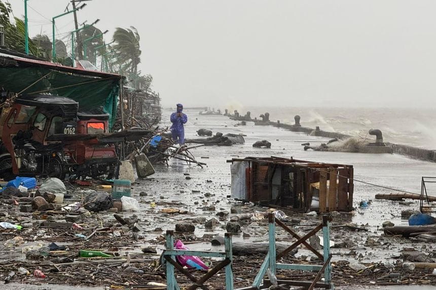
| Philippines | 2 dead | 7,000+ | Landslides, flooded villages, power outages |
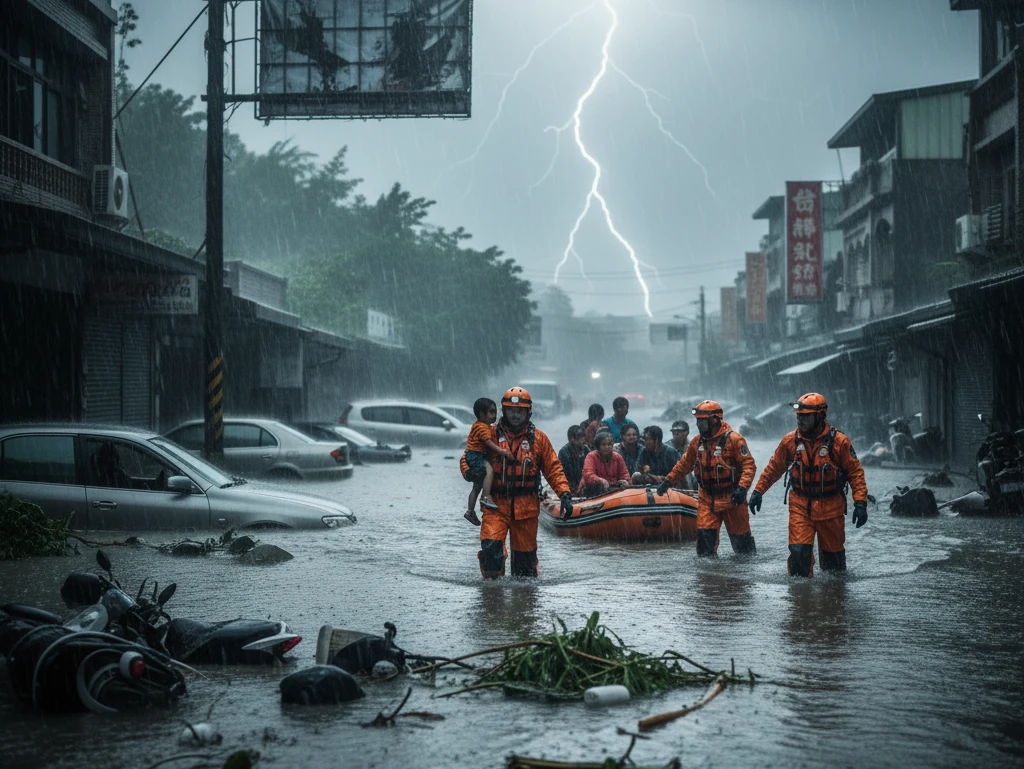
| Taiwan | 15 dead, 17 missing, 6 injured | 7,000+ | Lake burst floods, bridge collapses, flight cancellations |
| Hong Kong/Macau | 0 dead (as of Sept 24) | N/A | Tree falls, flooding, 500+ flight cancellations |
| China | TBD | 2 million | Storm surges, floating vehicles, infrastructure strain |
Casualty and damage estimates as of September 24, 2025.

Ragasa isn’t just a freak event—it’s a symptom. Warmer oceans, supercharged by human-induced global warming, provide more fuel for typhoons to intensify rapidly. “Storms like this are becoming the new normal,” says Dr. Emily Chen, a typhoon expert at the University of Hong Kong. The Philippines, Taiwan, and China—home to 500 million in the typhoon belt—face rising risks, with the World Meteorological Organization noting a 10-15% increase in super typhoon frequency since 2000.
Vulnerable communities bear the brunt: In the Philippines, poverty amplifies exposure, while Taiwan’s inquiry highlights gaps in aging infrastructure. As Ragasa dissipates inland, calls grow for resilient coastal defenses and emission cuts.
Relief efforts are in full swing. The Philippines’ Red Cross is distributing aid to Cagayan; Taiwan’s military aids Hualien searches; Hong Kong clears debris under sunny skies; and China’s Guangdong mobilizes 100,000 troops. Early estimates peg damages at $5-10 billion region-wide, with insurance claims surging.
For residents like Mak in Hong Kong, who sandbagged his home, it’s a stark reminder: “We prepare, but nature always wins.” As the 2025 typhoon season rages on, Asia braces for more. Stay informed, stay safe—follow live trackers from JTWC or PAGASA for updates.